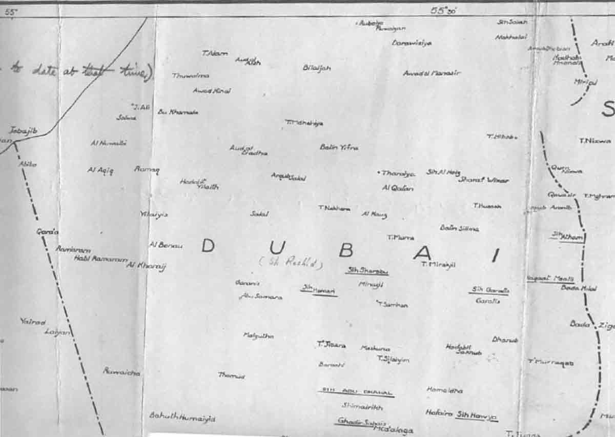
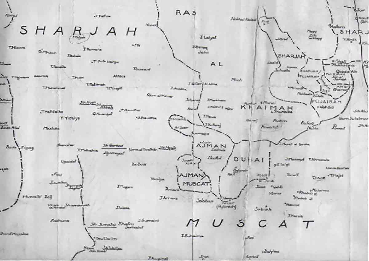
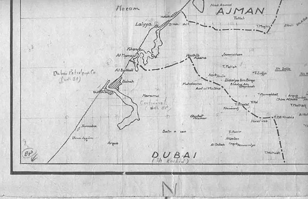
Trucial States Maps from 1965
Maps were drawn in 1965 by Julian Walker and Martin Buckmaster of the British Political Agency showing the Boundaries of each State.
Boundaries were often determined by Oasis and not, therefore, necessarily continous boundaries.