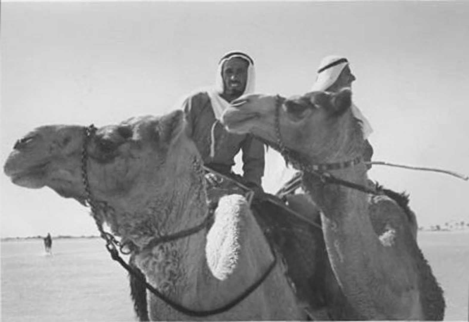
Search for Fresh Water in the Trucial States 1950/60s
Oil in the Trucial States was first discussed in 1922.
The first search for oil in the Trucial States was in 1936.
Search for Oil began in earnest in 1950s.
Finding Oil was about bringing wealth to the Trucial States.
Another less publicised search began in earnest in 1950s. That was the search for Fresh Water Supplies, essential to the health and well being of the Trucial States people.
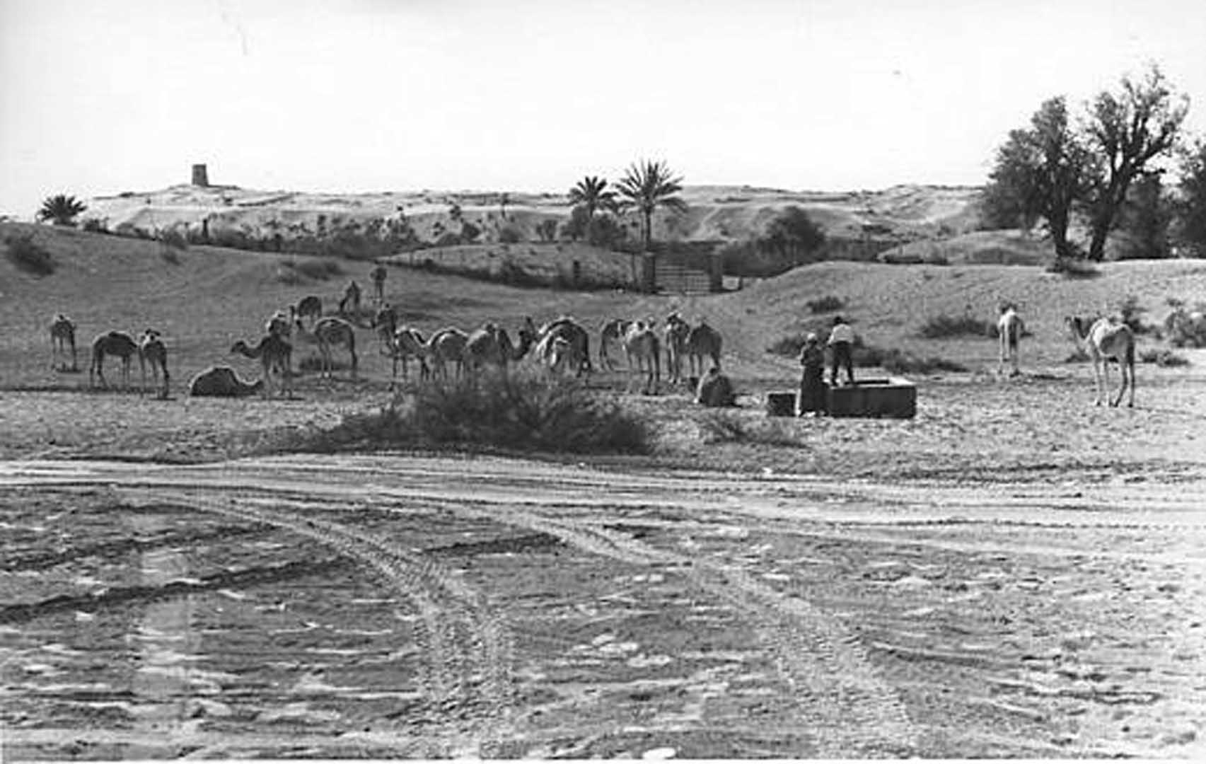
Back then, people depended on wells and rainfall to provide their fresh water. Many wells were contaminated which led to outbreaks of plagues and disease.
Peris Sinnett-Jones is a Water Resource Engineer
Peris was involved in Trucial States Water Source Surveys
Peris has kindly provided information about these 1950/60s Water Resource Surveys plus images taken during those Surveys.
Water Resources Surveys Timeline
-
1928
- - Geological Surveys carried out in South East Arabia
-
1950s
- - Detailed Geological Surveys carried out
-
1957
- - First Report by Hunting Technical Services relating to increasing water supply to Ras al Khaimah.
-
1959
- - Drilling company, Le Grand Adsco, submitted first report related to Dubai's Water Supply.
-
1962
- - Further Report on Dubai Water Supply by JD and DM Watson
-
1963
- - Ralph M Parsons submitted Report on Dubai Water Supply.
- Feasibility Reports for Sharjah Water Supply prepared by Sir William Halcrow and Partners. -
1964
- - F H Kocks of Koblenz submitted a Water Supply Report for Abu Dhabi.
-
1965
- - Following a reconnaissance survey between November 1964 and February 1965, Sir William Halcrow commissioned to carry out a water resources survey of the whole of the Trucial States over a period of three years.
- Eric Tulloch, Dubai State Engineer, prepared detailed technical notes on Dubai Water Supply.
Sir William Halcrow and Partners' Survey
Survey included:
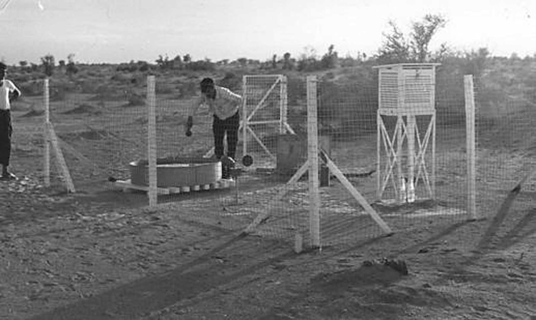
- Establishment of a network of rain gauges and climate stations;
- Drilling of observation boreholes for monitoring water level changes;
- Testing for yields of the aquifers and for establishing water balance;
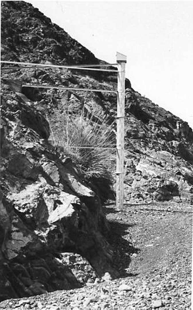
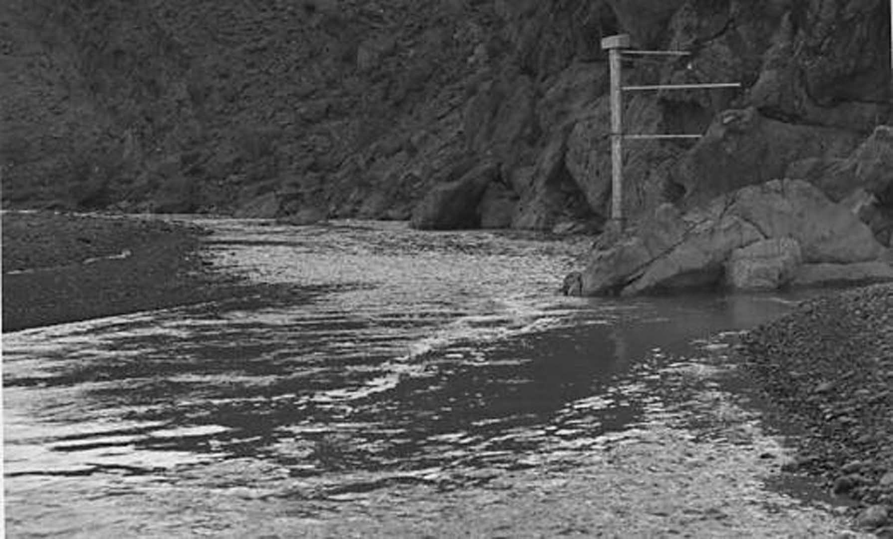
- Construction of weirs to measure surface flow;
- Monitoring of water levels and quality of water in existing wells.
As there was little ground levels data around the Trucial States, benchmarks were established around the area to enable water level contours to be drawn.
Existing Trucial States Maps comprised uncontrolled 1/100.000 military charts with approximate locations of wells and settlements, plotted from aerial photography.
A further map, produced by Julian Walker and Martin Buckmaster of the Political Agency, indicated the boundaries between States, was also available.
Location of wells and boreholes were only very approximate, so a Chobham Navigator was utilised to determine the location of these.
More Funding!
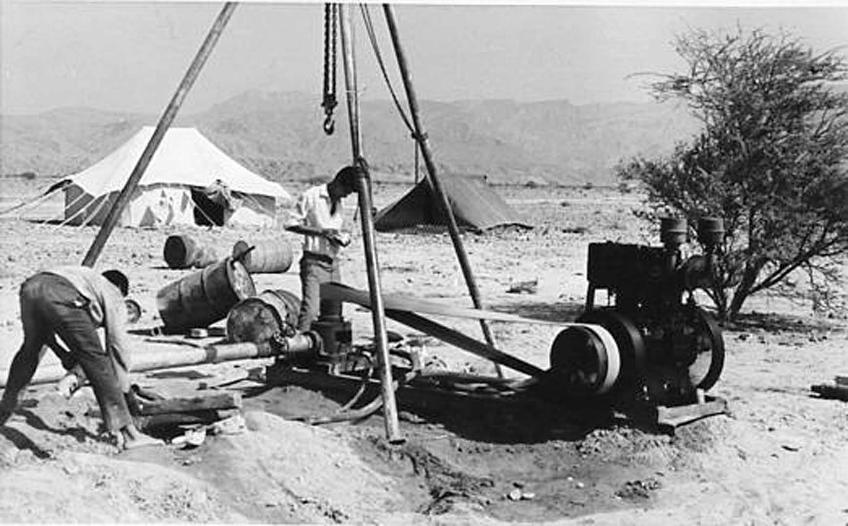
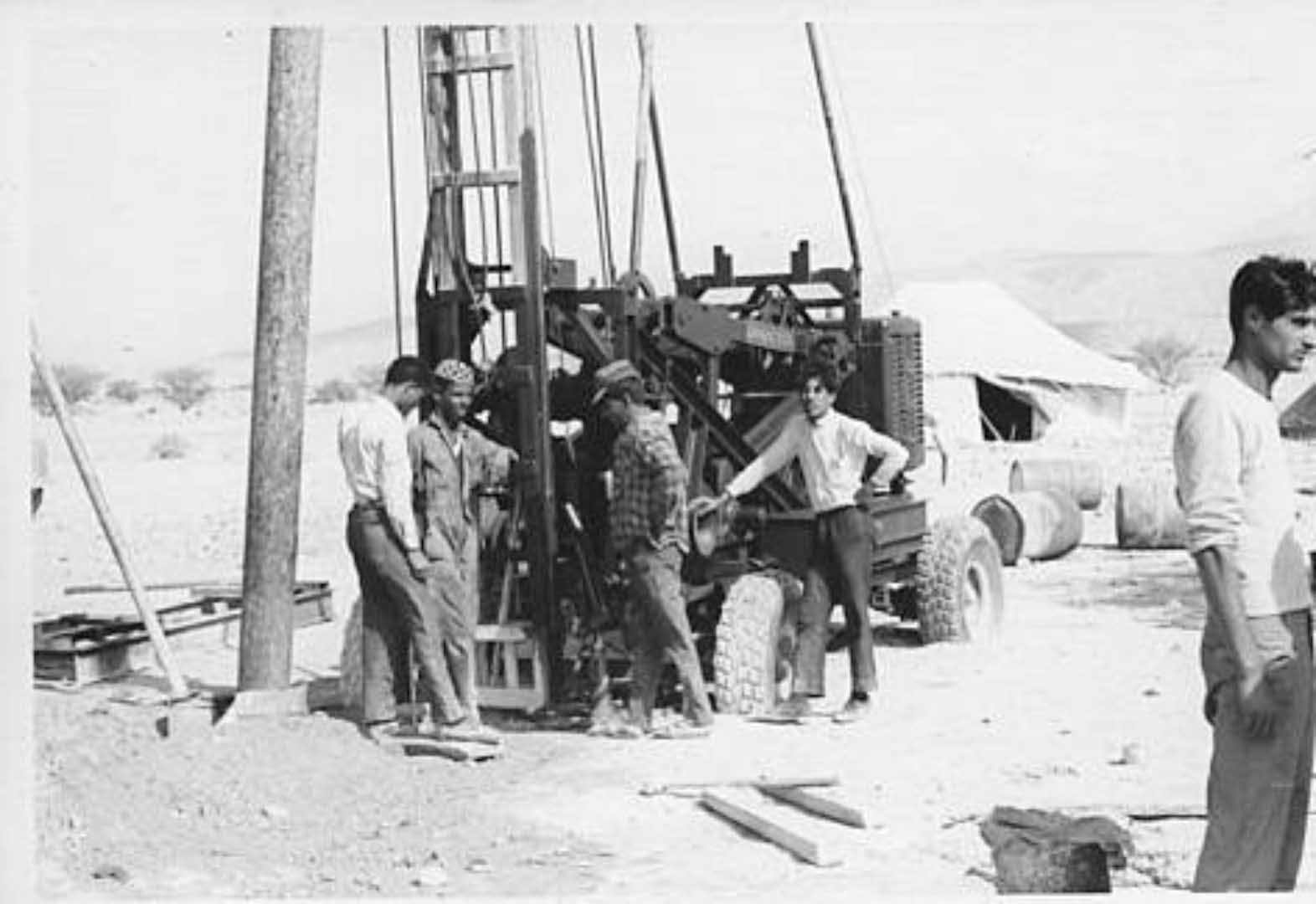
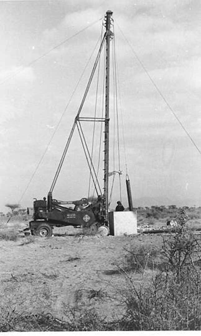
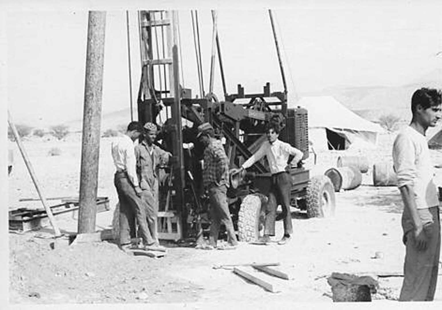
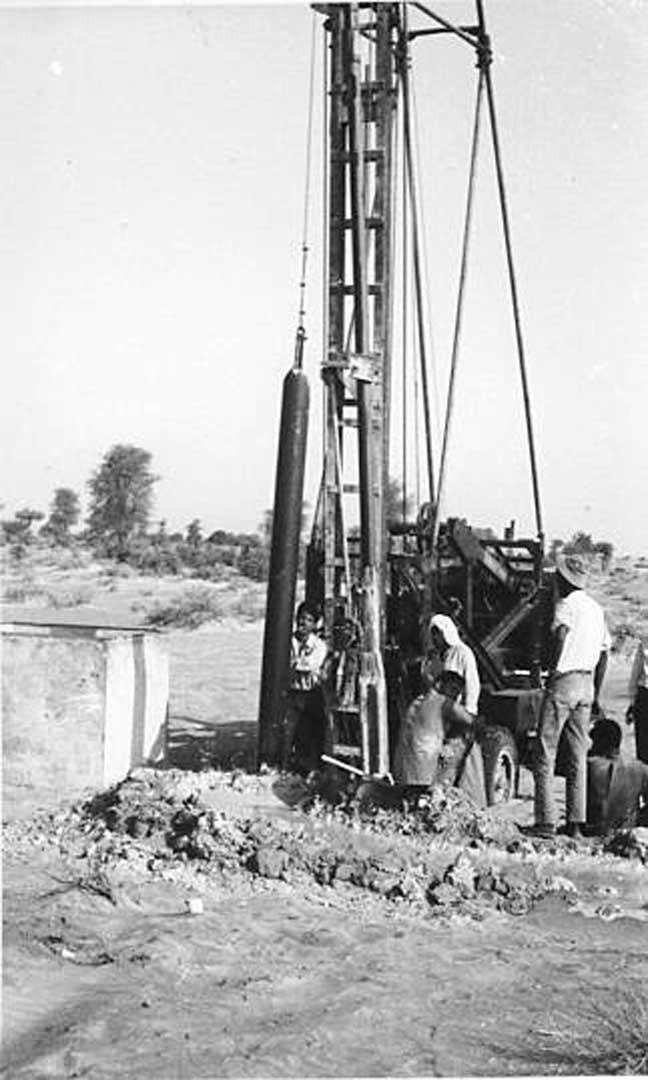
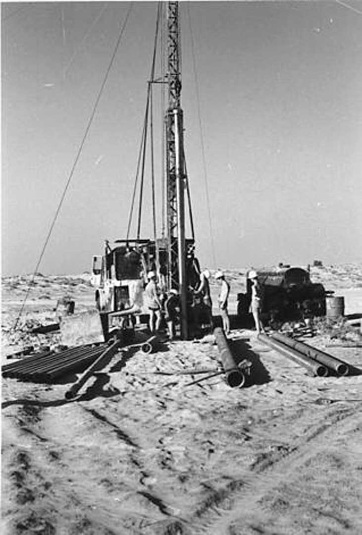
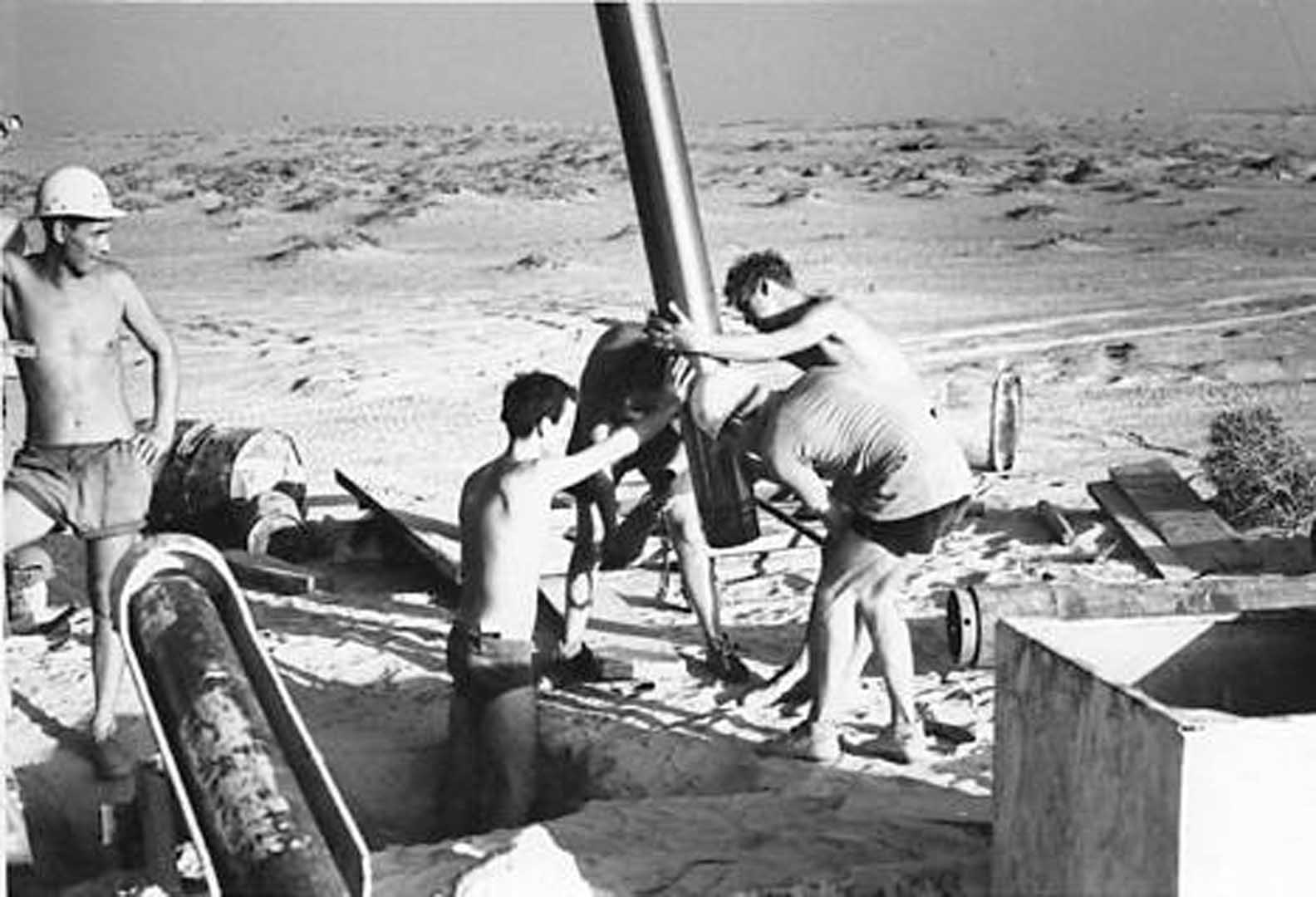
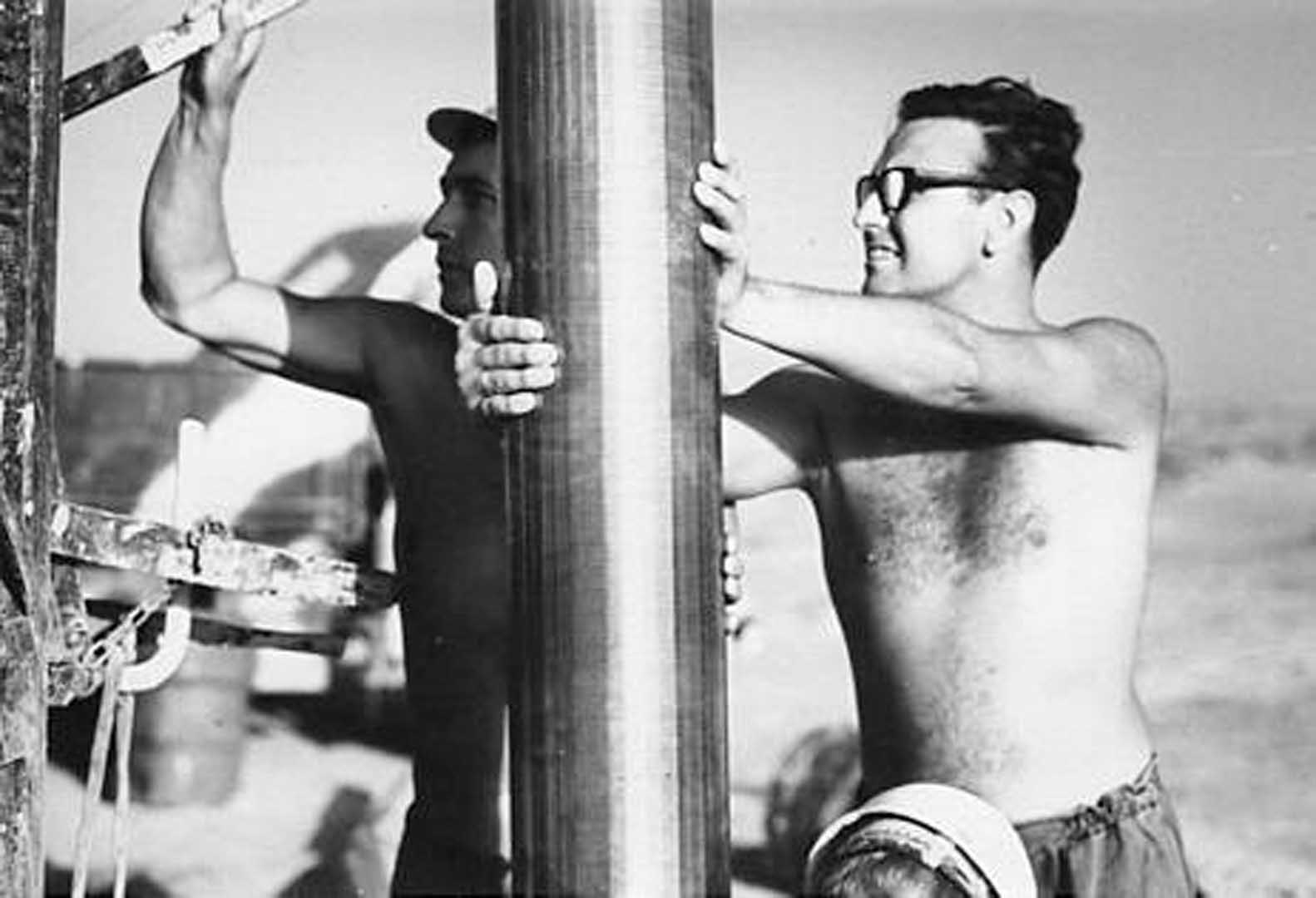
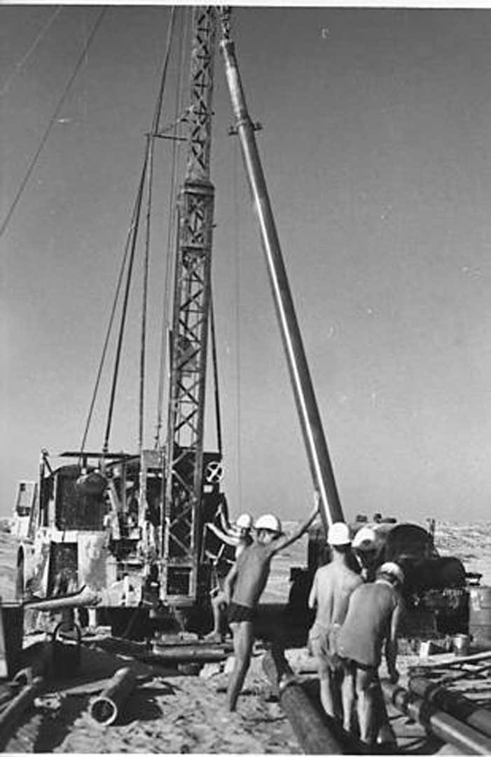
Funds were made available by Trucial States Council in the survey's first year for exploratory boreholes to be fitted with Desteco shaft driven borehole pumps belt driven by a single or twin cylinder Lister diesel engine. Thus a water development programme started providing a reliable supply of groundwater to many small settlements. A small reinforced concrete storage was constructed at most of these sites by a local contractor.
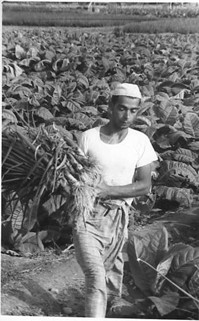
Agricultural Soil Survey
This was carried out by Durham University UK.
Two areas for detailed surveys were identified at Mileiha (Jebel Faiyah) and Hamraniyah (south of the experimental agricultural station at Digdaga).
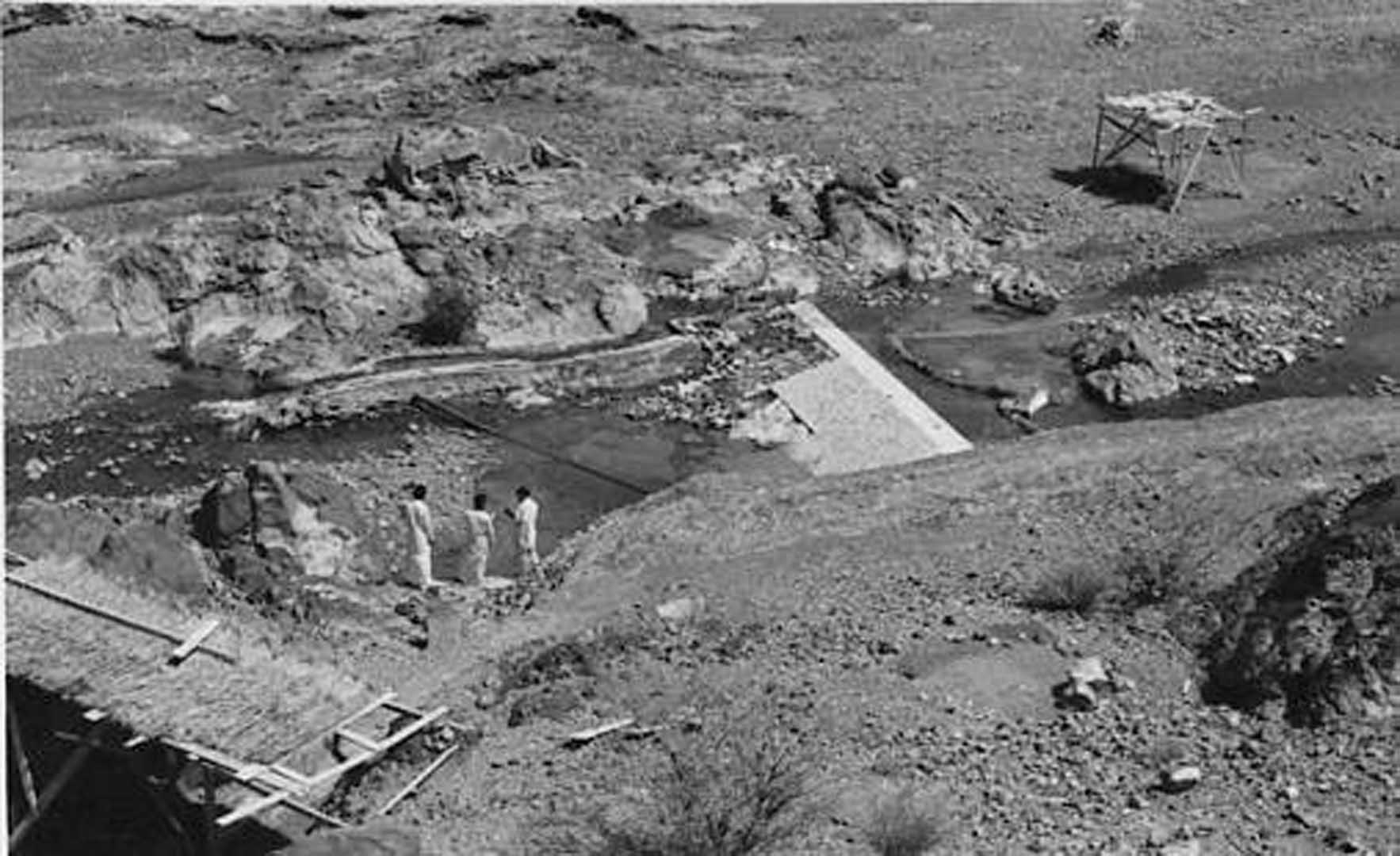
Funds were made available to develop irrigation for the 144 hectare site at Mileiha.
A wellfield of 12 boreholes was drilled about 1km to the south of the agricultural area. Boreholes pumped into two large 250 cu.m. reinforced concrete tanks which fed into a 300mm pipeline to the irrigated area.
Most of the irrigation was by conventional flood irrigation.
Two areas were set aside for an experimental sprinkler irrigated area, the first of its kind in the Arabian Gulf.
Main crops being irrigated were fodder crops and cash vegetable crops for sale in Dubai and Sharjah Markets.
Rainfall Records
Long term rainfall records from 1934/35 to 1963/64 were available for RAF Sharjah and the average monthly distribution was as follows:
| October | Nil |
| November | 14.0mm |
| December | 27.9mm |
| January | 25.4mm |
| February | 17.8mm |
| March | 10.2mm |
| April | 10.2mm |
| May | 0.3mm |
| June | Nil |
| July | 0.8mm |
| August | Nil |
| September | 0.3mm |
| Total Average Rainfall | 106.9mm |
| Maximum Annual | 340.4mm (1957) |
| Minimum Annual | 0.3mm (1961/62) |
| Maximum Monthly | 173.5mm (Dec. 1944) |
| Maximum Daily | 97.3mm (8th April 1957 |
Twelve rainfall and climatological stations were established around the Trucial States, centered on rural clinics, schools and military camps.
Monitoring Water Levels
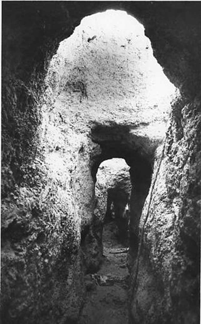
Water levels and water quality in wells and boreholes were carried out at quarterly intervals at some 100 sites around Trucial States. Flows and water quality from 25 springs and fallages were measured. Many were in a bad state of repair. A programme of rehabilitation was established, using Omani falaj specialists from Ibri.
Omanis required payment in Maria Therese Dollars
They did not trust paper currency!
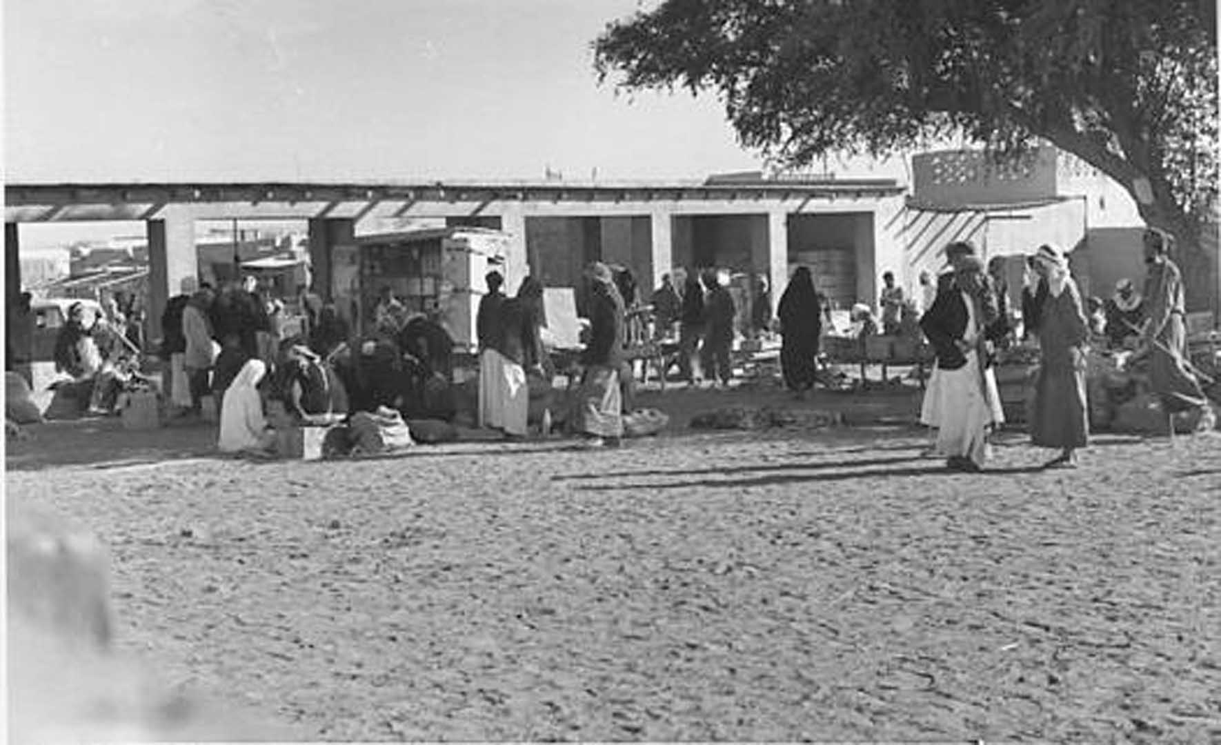
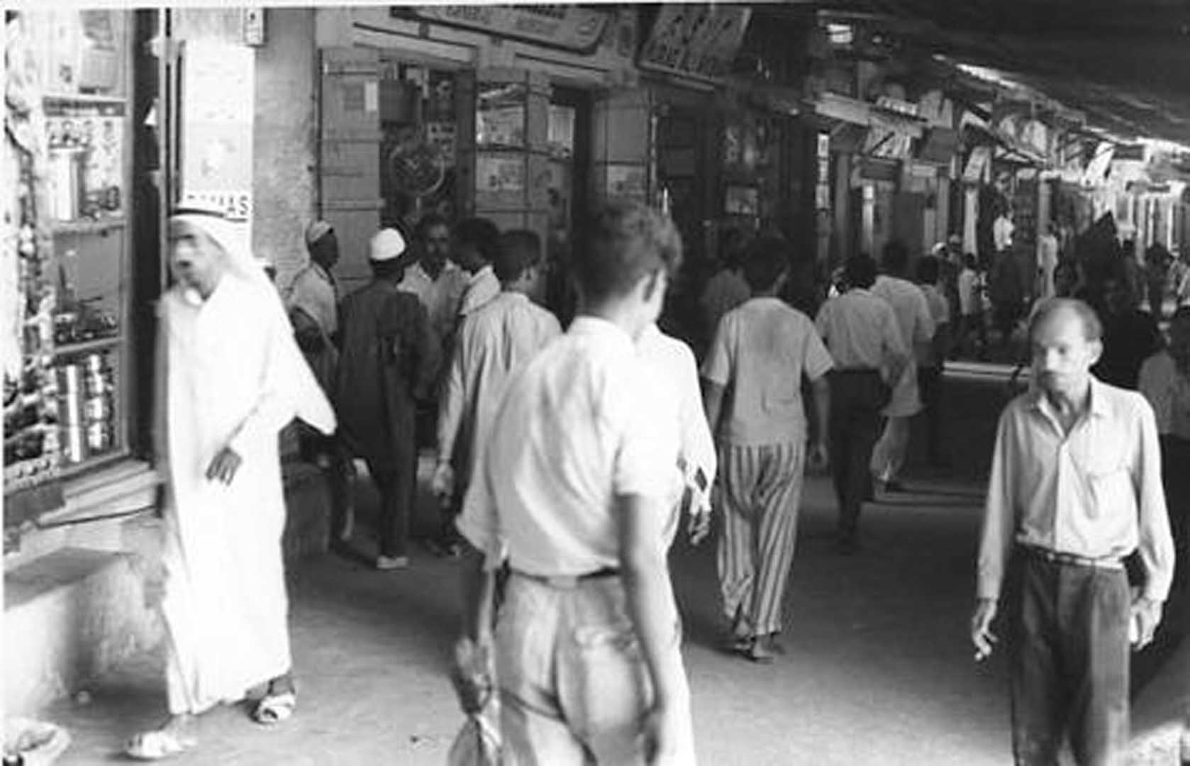
Agriculture, Trade and Water
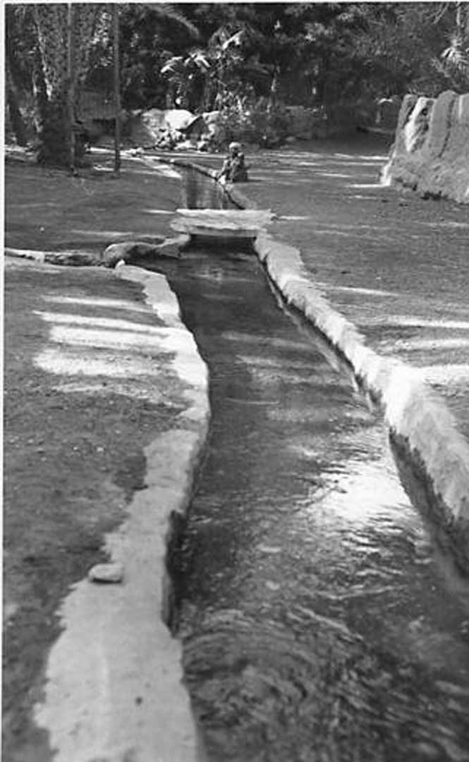
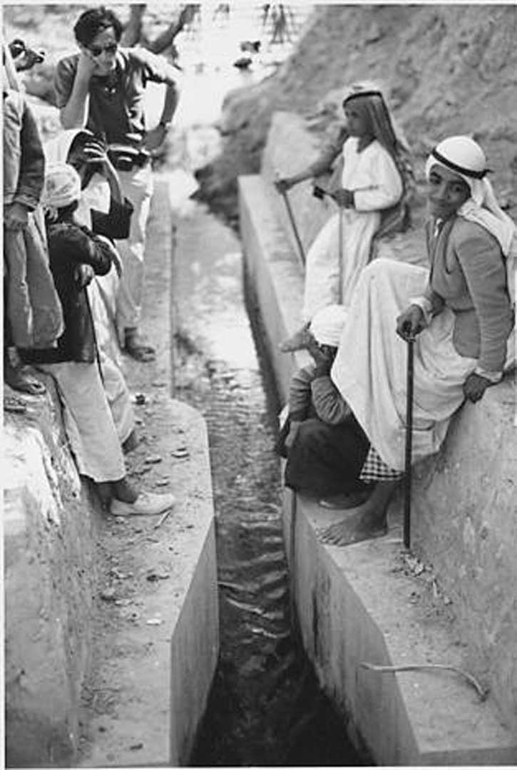
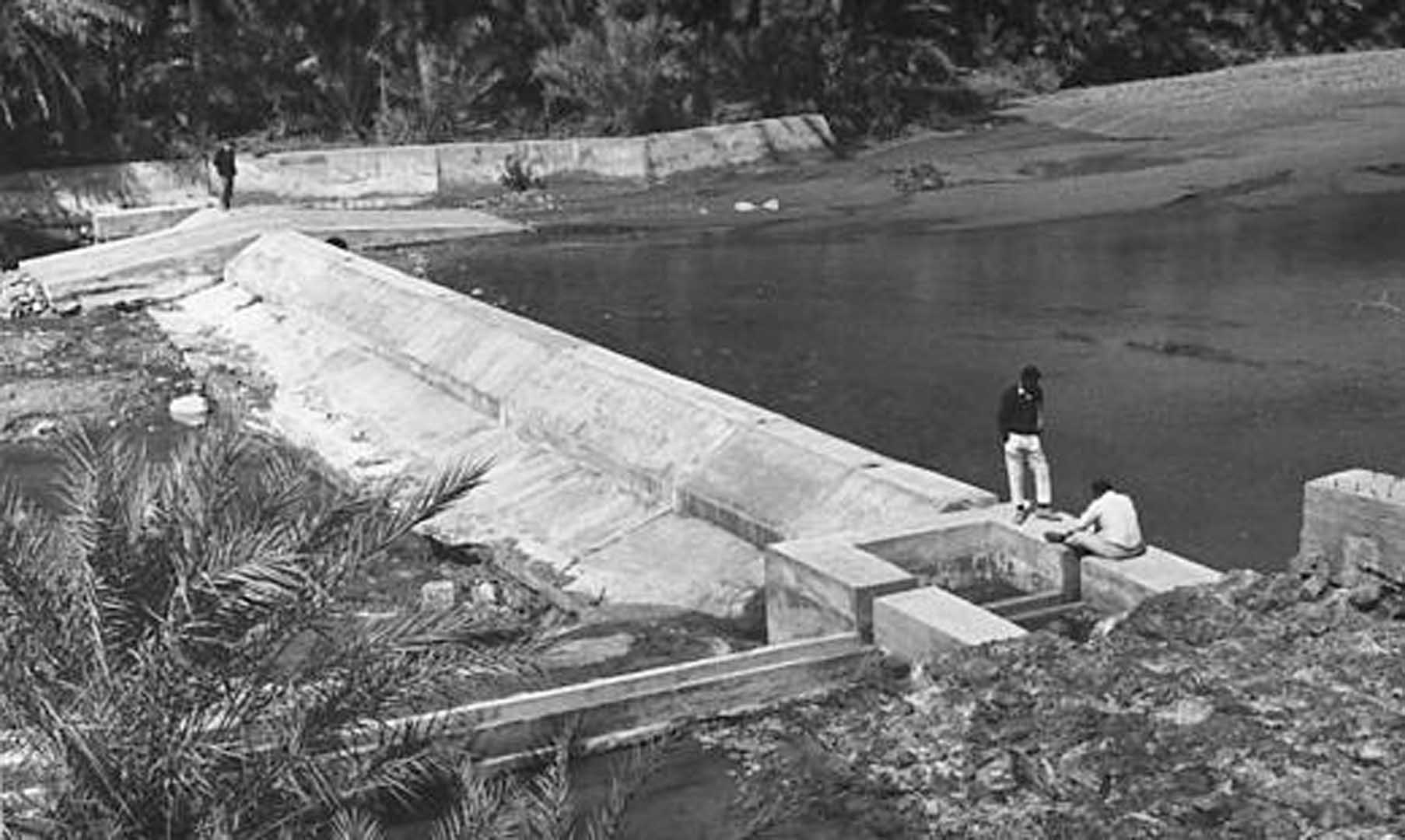
Often stream flows and pools were utilised for agriculture. These were improved by constructing concrete diversion weirs and channels to provide a reliable water source for local farmers.
Wadi Qor at Howeilat was one of the trade routes from Trucial States into Oman. A coffee house and resting place established next to the channel. Hammond Innes visited the area when researching for his book "The Doomed Oasis", based on 1950s Saudi Arabian territorial incursions at Al Liwa and Al Ayn/Buraimi Oases concerning water, oil and mineral rights.
In his book "A Harvest of Journeys", Hammond Innes writes that this coffee house is "No Tea House of the August Moon"
Trucial States Population
Approximate population for each of the Trucial States for 1965 was:
| Abu Dhabi | 20,000 |
| Dubai | 65,000 |
| Sharjah | 10,000 (excluding RAF Sharjah) |
| Ajman | 3,000 |
| Umm Al Qawain | 4,000 |
| Ras Al Khaimah | 11,000 |
| Fujairah | 4,000 |
| TOTAL | 125,000 |
The first official census took place in approx. 1970.
Approx. metered water supply consumption in 1965 was in the order of:
| Abu Dhabi | 1,500 m3/day |
| Dubai | 2,500 m3/day |
| Sharjah | 1,500 m3/day (including RAF Sharjah |
| Ras Al Khaimah | 1,000 m3/day |
Advent of oil exploration and development in late 1960s would see populations increase dramatically.
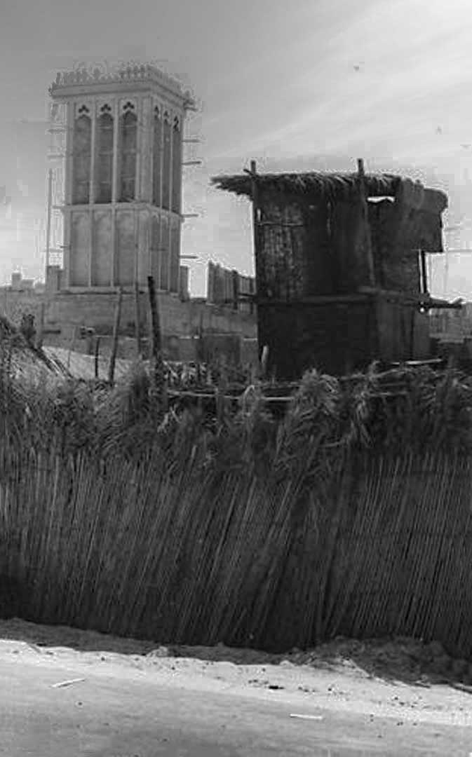
Development of Urban Areas
From 1966 onwards, there was increasing pressure on the supply of potable groundwater.
Wellfields and pipelines had already been established for Abu Dhabi (at Tawi Sa'ad to the west of Al Ayn;
for Dubai (at Tawi Awir to the west of Dubai);
for Sharjah (at Bidayat); for Ras al Khaimah (in the Wadi Bih to the east of Ras al Khaimah).
Ajman's supply was a spur main from Sharjah.
Umm al Qawain, Kelba, Fujairah, Khor Fakkan and Dibba relied on slightly brackish hand dug wells close to the coastline.
All these supplies were monitored at quarterly intervals by the survey.
Water supply for Umm al Qawain was commissioned in the late 1960s from a small wellfield to the north of Falaj al Mu'alla with a pipeline to Umm al Qawain.
East Coast Settlements Water Supply
Lined wells were hand-dug to the west of the settlements and provided with pumping equipment. Standpipes were located around the area.
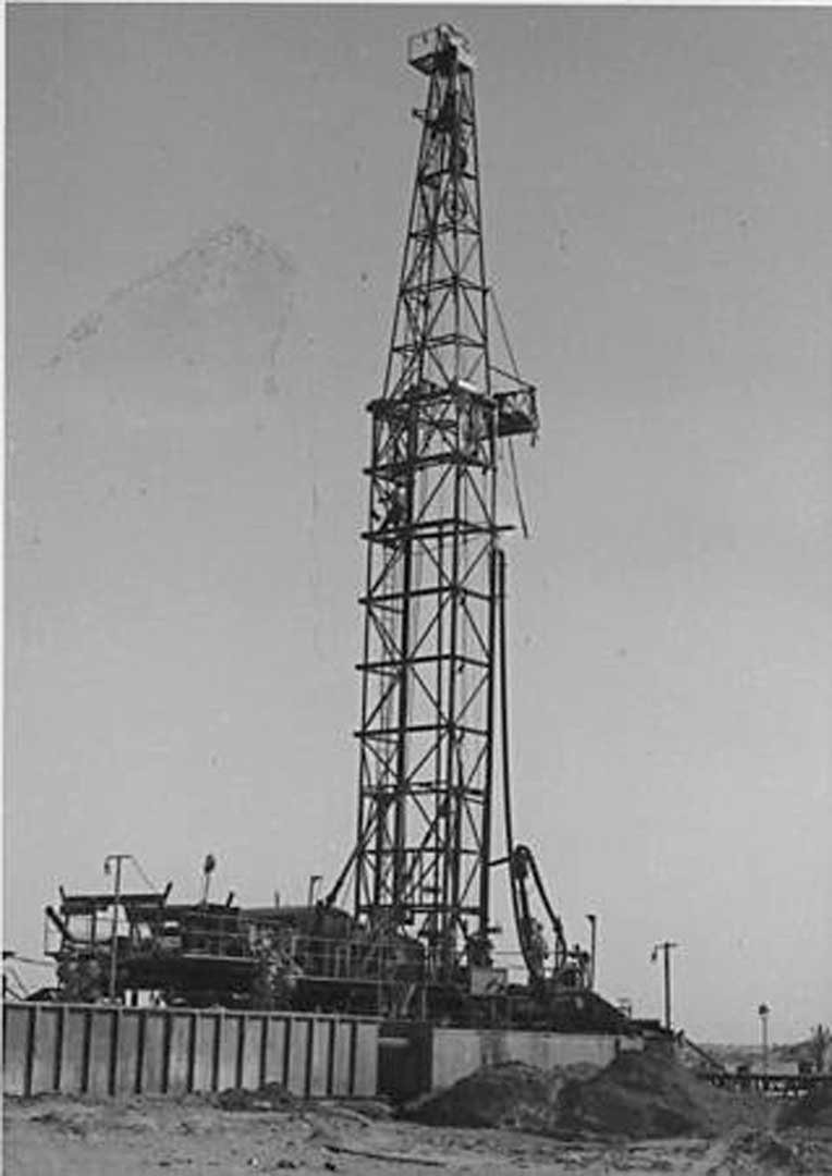
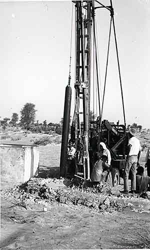
Additional boreholes were continuously being drilled and test pumped throughout the late 1960s for the expansion of Abu Dhabi, Dubai and Sharjah plus laying of larger diameter pipelines from the water sources.
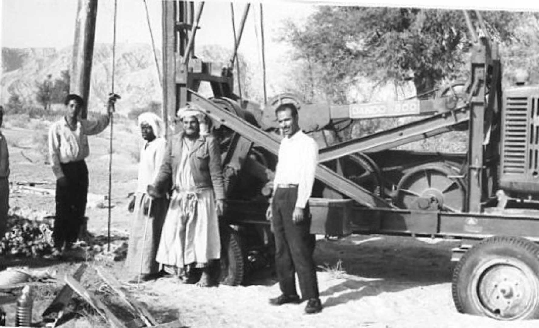
Local Water Drilling Company
Nasr Abdullatif and his son, Issa Nasr owned and operated the only local water drilling company. They had a small number of percussion drilling rigs. Other percussion drilling rigs were owned by Dubai Water Supply and the Trucial States Council.
Where deep drilling was required (e.g. at Khatt Springs) to investigate source of geothermal springs and pools, George Stow and Company were utilized. This company, along with Geoprosco, were based in Abu Dhabi and contracted to Abu Dhabi Oil Company for drilling of water boreholes supporting oil and gas exploration.
Close Co-operation
Dubai Water Supply and the Water Resources Survey worked cloely together. Assistance was provided to Dubai Water Supply in locating new boreholes at Awir and testing of new sources to south of Awir.
When there was any lull in Dubai Water Supply drilling, the rigs were loaned to the Water Resources Survey to drill additional development boreholes. Additional boreholes were drilled for Sharjah Water Supply to boost the capacity to Sharjah.
Drilling section of the Royal Engineers were temporarily based at RAF Sharjah following demobilization from Aden. They were utilised in this programme.
Irish Development Board donated stainless steel screens from Johnson Well Screens of Leixlip to Sharjah Water Supply. These were installed in boreholes at Bida’at by the Royal Engineers.
Further drilling took place to the east towards Dayd for possible future expansion. Ajman had a spur pipeline from Sharjah.
Only customer to pay for the water at Sharjah was the RAF Camp. They paid a farthing a gallon for their water – Sharjah's only government income at the time apart from grants provided by Abu Dhabi and Trucial States Council
Water Sources
Abu Dhabi water supply came from a well field at Tawi Sa'ad, some 100kms to the east of Abu Dhabi, not far from Al Ayn. Monitoring hese boreholes showed a “large scale pipeline leakage” between Tawi Sa’ad and Abu Dhabi. Leakage subsequently proved to be “unofficial” underground connections made by local farmers connecting their farms to the pipeline !!
Umm al Qawain’s water supply was developed in the late 1960s from a small wellfield to the north of Falaj al Ali. Drilling and siting of boreholes for this wellfield was undertaken by Nasr Abdullatif and his son Issa Nasr. Other boreholes had been sited in the area but were all brackish water.
Using his brass divining rods, Nasr was able to show where the fresher water was located. He was proven correct when new boreholes were drilled and tested!
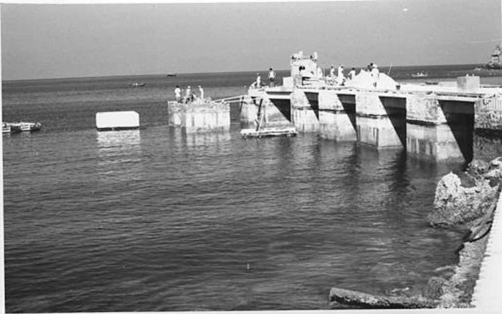
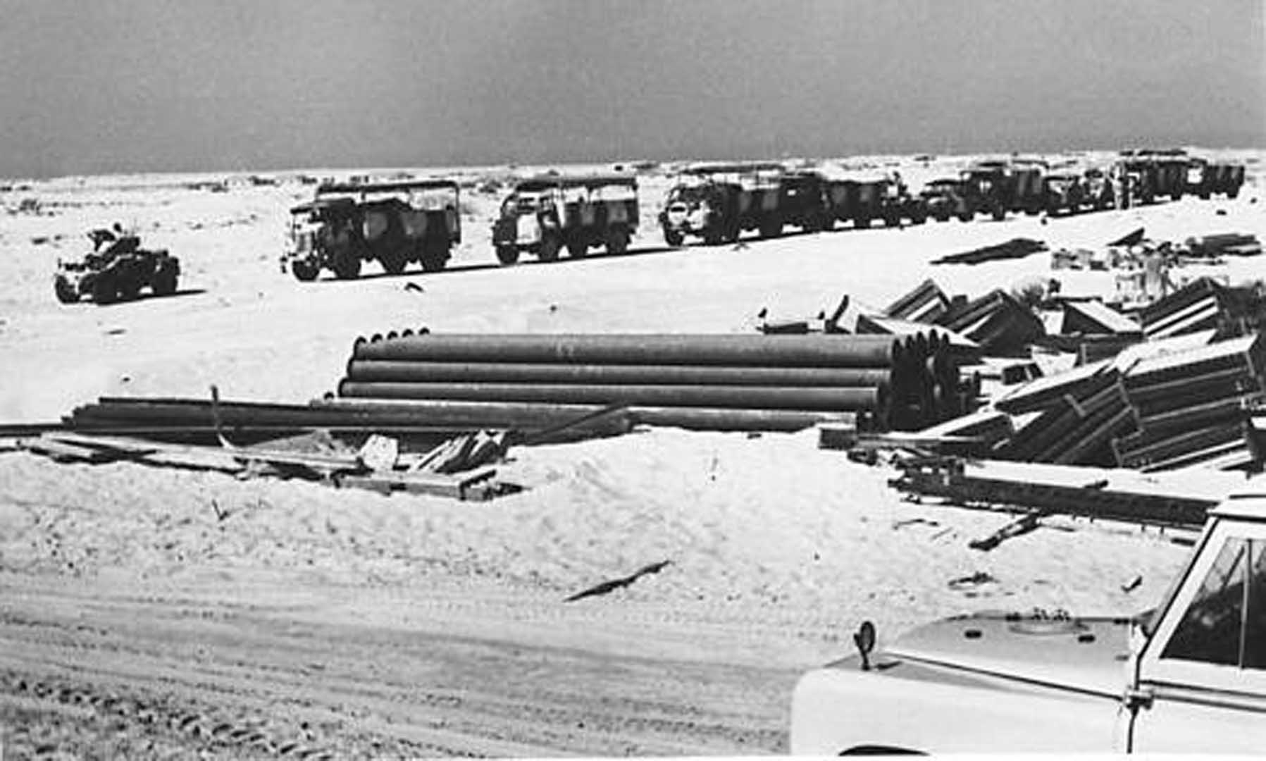
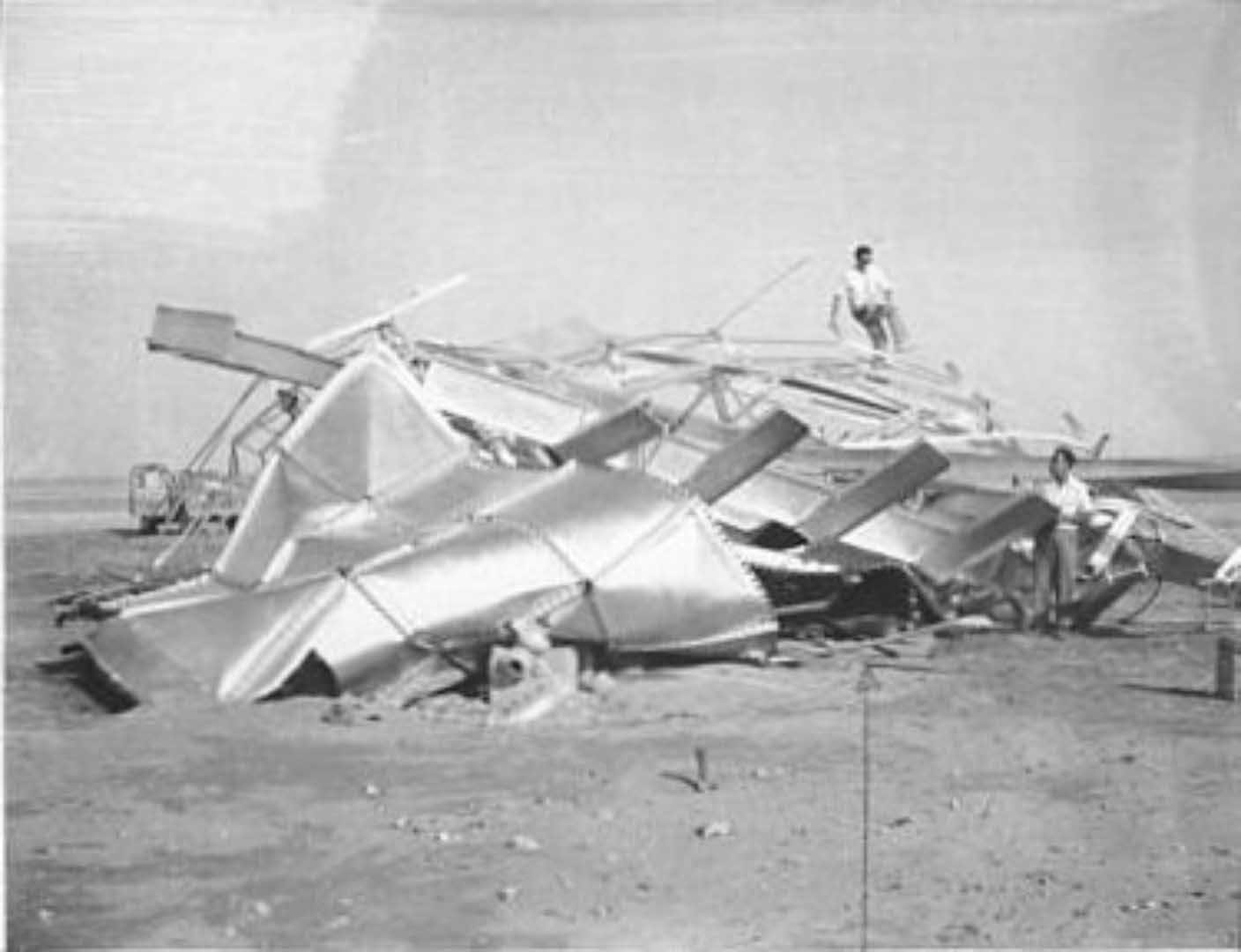
Prior to the final commissioning of the Braithwaite high level storage tank in October 1969, a very strong shimal developed along the coastline, resulting in the collapse of the complete tank structure.
Structural checks on all the high level steel storage tanks resulted in strengthening of foundation holding down bolts and other structural elements.
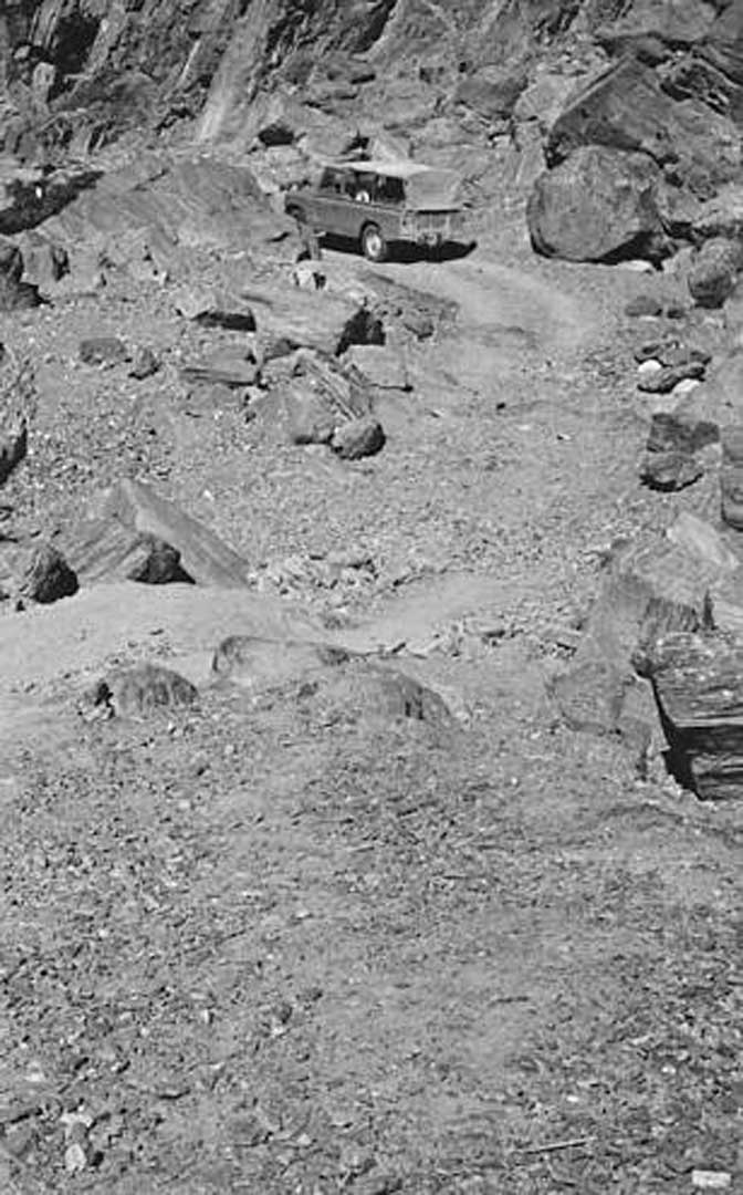
Ras al Khaimah water supply came from two or three boreholes located at the edge of Wadi Bih to the east. These were in disputed territory between Sheikh Saqr bin Mohamed of Ras al Khaimah and the Shihuh people in the Wadi Bih area). Not an area to visit too often!
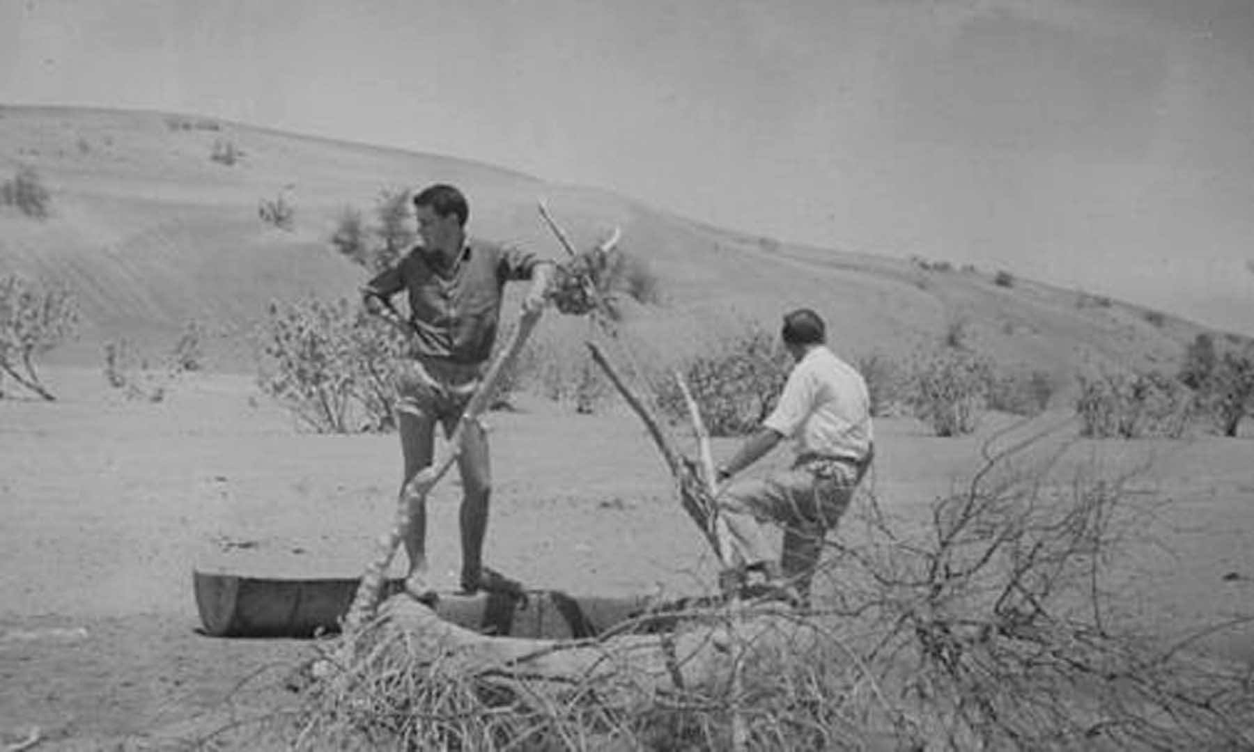
The Shihuh gave permission for a flood recording gauge to be placed in the Wadi Bih gorge. The steel box protecting the gauge was regularly used for target practice by the ShihuhCare had to be taken when changing the recording sheets!
Based on an official population census around 1968/69, a supplementary report was prepared to indicate future water requirements for each of the States. Indications were water demands would far exceed available groundwater supplies within a short time frame.
Feasibility of seawater desalination from offshore oil fields flared off gas was investigated together with reverse osmosis from brackish/saline water along the coastline. Onshore oil/gas had not been discovered at this stage.
An experimental solar still was set up at the Council’s workshops in Dubai, with the distilled water produced being used for water testing.
Water Survey Teams
FOR Trucial States Council:
- Brian Kendal Director
- Dick Rae Chief Engineer
- Mahmood Sawa'an Deputy Chief Engineer
- Dr Assim Jamali Director of Public Health
- Dr Hovenden Medical Officer - Rural Clinics
- Dr Colin Willson-Pepper Medical Officer – Jebel Faiyah
- Ted Morgan Chief Agricultural Officer - Digdaga
- Mohd Abdul Aziz Agriculturalist
- Dr Roy Ansell Government Vet at Digdaga
FOR Sir William Halcrow and Partners
- Noel Cochrane Supervising Partner
- Ivan Ward Recce Visit
- Andrew Kopec Team Leader
- Liam Sharkey Leave Replacement
- Alan Rendell Hydrogeologist
- John Smedley Hydrologist
- Peris Sinnett-Jones Water Resources Engineer
- Michael Attfield Construction Engineer
- Michael (died in climbing accident in 1969/70? on Hajar Mts near Ras al Khaimah)
CLICK IMAGE FOR IMAGE GALLERY